 PinCode Info Hub

Best PIN Codes to Live In: How to Evaluate a Neighbourhood Using Local Services
Choosing a place to live is about much more than finding a beautiful house or an affordable apartment. The neighbourhood surrounding your home can influence your daily routine, commuting time, access to healthcare, shopping convenience and overall quality of life.Two homes with similar prices can offer very different living experiences depending on the facilities available nearby. One may have a hospital, supermarket, school and public transport within easy reach, while the other may require a long journey for everyday needs.This is where PIN code and locality information can become useful.In India, a PIN code helps identify a postal delivery area. When combined with information about nearby services and infrastructure, it can provide a useful starting point for evaluating a neighbourhood before renting or purchasing a home.In this guide, we explain how to use PIN code information and nearby facilities to assess a residential area more systematically.
What Makes a PIN Code a Good Place to Live?
There is no single PIN code that is best for everyone.A neighbourhood that works well for a family with school-age children may not be the best choice for a professional who travels daily to a central business district. Similarly, a retired person may prioritise healthcare access and a peaceful environment, while a student may look for affordable accommodation near educational institutions.
A good residential location generally offers a suitable combination of:
– Access to essential services.
-Convenient transportation.
-Reasonable commuting distances.
-Access to schools and healthcare.
-Grocery stores and other everyday facilities.
-Appropriate housing costs.
-A comfortable and safe living environment.
-Infrastructure that meets the household’s needs.
A PIN code can help you begin exploring an area, but the final decision should be based on the specific neighbourhood and property.
Start With the PIN Code and Locality
Before visiting a property, identify its PIN code and the locality in which it is situated.
This gives you a starting point for researching the surrounding area.
Using a PIN code lookup or locality search tool, you can investigate postal information and identify the general area associated with an address.
You can then explore nearby facilities using mapping services and available geographic information.
Before visiting the property, you might want to identify:
-The nearest supermarket.
-Hospitals and clinics in the surrounding area.
-Schools and colleges.
-Bus stops, metro stations or railway stations.
-Banks and ATMs.
-Parks and recreational facilities.
-Petrol pumps and other essential services.
This preliminary research helps you prepare a list of questions to investigate during your property visit.
Important: A PIN code can cover multiple neighbourhoods, villages or delivery areas. Two properties sharing the same PIN code may have very different levels of access to local services. Always evaluate the specific address rather than judging the entire area by its PIN code alone.
Consider Parks and Recreational Spaces
A residential area is not defined by essential services alone.
Parks, playgrounds and recreational spaces can make a neighbourhood more attractive for families, walkers and people who enjoy outdoor activities.
Useful facilities to investigate include:
-Public parks.
-Children’s playgrounds.
-Walking tracks.
-Sports grounds.
-Community recreation spaces.
Check whether these places are accessible to the public and whether their location suits your routine.
A park appearing on a map may be privately managed, restricted to residents or difficult to access from the property.
Visit the area when possible to understand its condition, accessibility, maintenance and level of activity.
Green spaces can contribute to a pleasant residential environment, but their presence alone does not establish the overall quality of a neighbourhood.
Investigate Safety and Essential Public Services
Feeling comfortable in your neighbourhood is essential when selecting a home.
Online research can help identify public services, but safety requires more than looking at a map.
Facilities worth investigating include:
-Police stations.
-Fire stations.
-Hospitals and emergency healthcare facilities.
-Well-connected roads.
-Public transport access.
The presence of a nearby police station does not necessarily mean an area is safer than another locality.
Similarly, the absence of a listing on a map does not prove that a service is unavailable.
To assess a neighbourhood more carefully:
-Visit the area at different times of day.
-Observe street lighting and pedestrian access.
-Check road conditions and traffic patterns.
-Speak with current residents where possible.
-Review credible local information about the area.
-Ask the landlord, housing society or property manager about relevant concerns.
Families may also want to assess school routes, access to emergency services and the availability of reliable transport at night.
Use online information as a starting point, not as a substitute for checking the neighbourhood in person.
How PinCode Info Hub Can Help With Locality Research
PinCodeInfoHub helps users explore Indian PIN codes, post offices and locality-related information through a searchable interface.
Instead of beginning with a broad web search, users can start by identifying a PIN code or locality and then investigate relevant information about the area.
The platform’s nearby-services and area-exploration features can help users discover mapped facilities and places around a location.
These features can support preliminary research when comparing potential residential areas.
For example, before visiting a property, you could:
-Search for its PIN code or locality on PinCodeInfoHub.
-Review the available postal and locality information.
-Explore the nearby facilities displayed by the platform.
-Identify services that are important to your household.
-Verify the facilities and travel routes independently.
Visit the property and evaluate the neighbourhood in person.
The platform should be treated as a starting point for exploration, not as a property-rating service or a guarantee that a neighbourhood is suitable for everyone.
You can use PinCodeInfoHub to begin exploring PIN codes and nearby locations before making your own assessment.
How Small Business Owners Use PIN Code Intelligence to Choose Shop Locations
Choosing the right shop location is one of the most important decisions for any small business owner. Whether opening a pharmacy, bakery, mobile store, clinic or retail outlet, location often determines how successful the business will become.While factors such as rent, visibility and competition are commonly considered, many entrepreneurs now use PIN code intelligence to make smarter decisions.PIN code information can reveal valuable insights about an area’s accessibility, population concentration and service ecosystem.This article explains how small business owners can use PIN code intelligence to choose better business locations.
What Is PIN Code Intelligence?
PIN code intelligence is the process of using postal and locality information to better understand an area before making business decisions.
Instead of looking only at a street address, business owners study factors associated with a PIN code such as:
– Nearby facilities
– Residential density
– Commercial activity
– Transportation connectivity
– Accessibility
– Existing service availability
Together, these factors help identify whether a location is suitable for a particular business.
Why Location Matters More Than Ever
Modern customers expect convenience.
People prefer businesses that are:
– Easy to find
– Close to residential areas
– Near transportation hubs
– Accessible to delivery services
– Located near complementary businesses
A good location can increase foot traffic and improve customer retention.
Choosing the wrong location may lead to low visibility and reduced sales.
How PIN Codes Help Evaluate Areas
A PIN code is more than a postal identifier. It often represents an entire neighbourhood ecosystem.
By studying a locality associated with a PIN code, business owners can evaluate the surrounding environment.
Useful indicators include:
– Nearby banks
– Hospitals
– Schools
– Restaurants
– Petrol pumps
– Railway stations
– Parks
– Universities
These facilities often indicate active and growing communities.
Understanding Population Density, Evaluating Competition, Transportation Connectivity and E-Commerce and Delivery Advantages
Areas with higher residential density may offer greater customer potential.
For example:
– A grocery store benefits from being close to apartment complexes.
– A pharmacy may perform better near hospitals and clinics.
– A café may benefit from being located near offices, colleges or commercial districts.
PIN code analysis helps identify these opportunities.
Business owners should also understand existing competition.
Questions to ask include:
– Are there already many similar businesses nearby?
– Is there unmet demand?
– Is the area still growing?
– Sometimes an area with moderate competition performs better than an overcrowded market.
Well-connected areas often attract more visitors.
Indicators include:
– Railway stations
– Bus terminals
– Metro stations
– Main roads
Customers prefer businesses that are easy to reach.
Delivery companies also operate more efficiently in accessible areas.
Online businesses increasingly depend on PIN code serviceability.
Delivery partners use PIN codes to determine:
– Delivery availability
– Shipping timelines
– Logistics costs
– Businesses operating in well-served PIN code areas may offer faster deliveries to customers.
This can improve customer satisfaction and repeat purchases.
Examples of Businesses That Benefit From PIN Code Analysis, Questions Every Business Owner Should Ask And How Digital Tools Are Changing Location Decisions
Many businesses can use locality intelligence before selecting a shop location.
Examples include:
– Retail Stores : Retail outlets benefit from strong residential and commercial activity.
– Pharmacies : Locations near hospitals and clinics often perform well.
– Restaurants and Cafés : Areas near offices, colleges and parks may generate regular customer traffic.
– Salons and Service Centres : Residential neighbourhoods often provide a stable customer base.
– Convenience Stores : Apartment communities and busy localities create steady demand.
Questions Every Business Owner Should Ask
Before choosing a location, consider:
– Is the area easily accessible?
– Are there enough residents nearby?
– Are public facilities available?
– Is the area growing?
– Are delivery services available?
– Is competition manageable?
These questions help reduce risk before investing.
How Digital Tools Are Changing Location Decisions
Today, business owners no longer need to rely only on physical visits.
Digital location tools can provide valuable insights such as:
– PIN code information
– Locality details
– Nearby facilities
– Area connectivity
– Service availability
This allows entrepreneurs to make more informed decisions before opening a business.
The Future of Location Intelligence :
As Indian cities continue to expand, location intelligence will become increasingly important.
Smart businesses are beginning to use data-driven approaches instead of relying solely on intuition.
Postal information, nearby services and locality insights can collectively provide a clearer picture of an area’s potential.
What Happens When a New Township Gets a PIN Code? The Process Explained
Learn how new townships and growing urban areas receive PIN codes in India. Understand the role of India Post, post offices and postal planning.
As cities expand and new residential townships emerge, postal services must adapt to serve growing populations efficiently. One common question people ask is: How does a new township receive its own PIN code?While many assume a PIN code is assigned automatically when a new area is developed, the actual process involves planning, postal administration, logistics, and public service considerations.In this article, we explore how new townships become part of India’s postal network and what happens before a new PIN code is assigned.
Why New Townships Need Postal Identification
Modern townships often include thousands of homes, apartments, offices, schools, hospitals, and commercial establishments.
Initially, a newly developed area may use the PIN code of a nearby locality or existing post office. As the population grows, this arrangement can create challenges such as:
– Increased mail volume
– Delivery delays
– Address confusion
– Administrative inefficiencies
– Rapid growth in e-commerce deliveries
– To improve service quality,
India Post may review the area’s postal requirements.
Does Every New Township Get a New PIN Code?
Not necessarily.
Many developing localities continue to operate under an existing PIN code for several years.
A new PIN code is generally considered only when:
– Population increases significantly
– Postal traffic grows substantially
– Existing delivery infrastructure becomes overloaded
– A separate post office is required
– Administrative convenience justifies a new postal identity
The decision depends on practical postal requirements rather than real estate development alone.
The Role of India Post
India Post continuously monitors operational requirements across the country.
When an area experiences rapid urban growth, postal authorities may conduct assessments related to:
– Population density
– Mail volume
– Delivery routes
– Distance from existing post offices
– Future development projections
These factors help determine whether the existing postal structure can continue serving the area efficiently.
Establishment of New Post Offices
Before a new PIN code is assigned, a new post office may need to be established.
Depending on local requirements, the facility may be categorized as:
– BO (Branch Office)
– SO (Sub Office)
– HO (Head Office)
The type of office depends on the expected workload and administrative structure of the region.
The creation of a new post office often forms the foundation for future postal reorganization.
How PIN Code Assignment Works
Once postal authorities determine that a separate postal identity is necessary, the area may be assigned a PIN code within the existing postal hierarchy.
The new PIN code is integrated into:
– Regional sorting systems
– Postal databases
– Delivery routes
– Address management systems
This ensures that mail can be sorted and delivered accurately.
The first few digits of the PIN code generally continue to reflect the broader postal zone and district structure already established for that region.
Impact on Residents and Businesses
A new PIN code can provide several advantages.
– Improved Delivery Accuracy : Dedicated postal identification helps reduce confusion between neighboring localities.
–Faster Mail Processing: Sorting centers can route deliveries more efficiently.
– Better E-Commerce Support : Online retailers and logistics companies often rely heavily on PIN codes for serviceability checks.
– Clearer Address Identification : Residents and businesses gain a more precise location identity.
Challenges During Transition:
Whenever a new PIN code is introduced, there may be a temporary transition period.
Residents may need to:
– Update addresses
– Inform banks and service providers
– Modify business records
– Update e-commerce delivery information
Over time, however, the new postal identity becomes widely recognized.
Examples of Growing Urban Areas :
India’s rapidly expanding urban regions regularly create demand for postal restructuring.
Examples include:
– New residential corridors
– Satellite townships
– IT and technology parks
– Industrial development zones
– Urban expansion projects
As these areas mature, postal infrastructure evolves alongside them.
The Future of PIN Codes in Expanding Cities:
India’s urban landscape continues to change rapidly.
Smart cities, integrated townships and large-scale infrastructure projects are creating entirely new communities. As these developments grow, postal services must continuously adapt to maintain efficient delivery networks.
While not every township receives a unique PIN code immediately, expanding regions often influence future postal planning and infrastructure decisions.
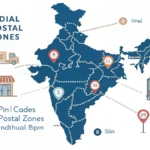
How India’s PIN Code Zones Map to States: A Visual Guide

Photo by Gayatri Malhotra on Unsplash
Indian PIN Code System-Visual Guide
India’s Postal Index Number (PIN) system is one of the most efficient postal addressing systems in the world. Introduced by India Post in 1972, the PIN code system helps identify locations quickly and ensures accurate delivery of mail and parcels across the country. While most people use PIN codes daily, many are unaware that the first digit of every PIN code represents a specific postal zone covering multiple states and regions. This guide explains how India’s PIN code zones are organized and how they map to different parts of the country.

Photo by Huzaifa Ginwala on Unsplash
What Is a PIN Code?
A PIN Code (Postal Index Number) is a six-digit number used by India Post to identify specific delivery regions.
A typical PIN code looks like this:500001 Each digit has a specific meaning:
First digit: Postal Zone
Second digit: Sub-Zone
Third digit: Sorting District
Last three digits: Individual Post Office
The first digit is the most important for understanding India’s postal geography.
India’s 9 Postal Zones
India is divided into nine major PIN code zones.
The first eight zones cover geographical regions, while the ninth zone is reserved for the Army Postal Service.
Zone 1 States Covered: Delhi, Haryana, Punjab, Himachal Pradesh, Jammu & Kashmir, Chandigarh
Example PIN Codes:
110001 (New Delhi)
160017 (Chandigarh)
Zone 2 States Covered: Uttar Pradesh, Uttarakhand
Example PIN Codes:
226001 (Lucknow)
248001 (Dehradun)
Zone 3 States Covered: Rajasthan,Gujarat,Dadra and Nagar Haveli Daman and Diu
Example PIN Codes:
302001 (Jaipur)
380001 (Ahmedabad)
Zone 4 States Covered: Maharashtra, Madhya Pradesh,Chhattisgarh, Goa
Example PIN Codes:
400001 (Mumbai)
462001 (Bhopal)
Zone 5 States Covered: Andhra Pradesh,Telangana,Karnataka
Example PIN Codes:
500001 (Hyderabad)
560001 (Bengaluru)
520001 (Vijayawada)
Zone 6 States Covered: Tamil Nadu, Kerala, Puducherry, Lakshadweep
Example PIN Codes:
600001 (Chennai)
682001 (Kochi)
Zone 7 States Covered: West Bengal, Odisha, Assam, North Eastern States
Example PIN Codes:
700001 (Kolkata)
751001 (Bhubaneswar)
Zone 8 States Covered: Bihar, Jharkhand
Example PIN Codes:
800001 (Patna)
834001 (Ranchi)
Zone 9 Reserved For: Army Postal Service (APS)
These PIN codes are used for military communication and logistics.
Why Are PIN Code Zones Important?
PIN code zones help India Post process and route millions of letters and parcels every day.
Benefits include:
1. Faster sorting of mail
2. Reduced delivery errors
3. Better logistics planning
4. Improved e-commerce delivery efficiency
5. Accurate location identification
Without PIN codes, similar locality names across different states could create confusion and delays.
Interesting Facts About India’s PIN Code System :
1. The PIN system was introduced on 15 August 1972.
2. India has more than 150,000 post offices.
PIN codes help both postal and digital commerce operations. Major cities may contain hundreds of individual PIN codes.